PPL Theory - Communication (COM)
Categories:
Exam passed on January 26 2026.
For a live overview of my flight lessons, visit: https://flighttools.justinverstijnen.nl/flightlessontracker
This page can contain a collection of personal notes, steps to remember, finished and unfinished content. Please excuse brevity.
Do not use specific information given like fuel flow, landing/take-off distances for your flights. Always refer to the POH of your exact plane for flight preparation. My information is just for references that I used.
Introduction
This page contains only some theoretical additions to this page: https://justinverstijnen.nl/flight-rt-course-notes/
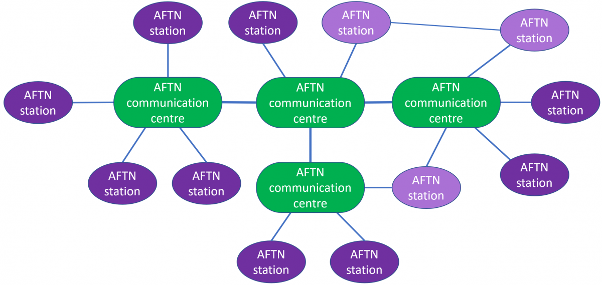
The International Aeronautical Telecommunication Service (IATS)
Clearances
When you want to cross a runway, you have to request this:
- Request cross runway XX
When a radio frequency must be silent due to emergencies, the following will be called:
- STOP TRANSMITTING MAYDAY
- And also make sure to not disturb any distress messages
- Always mention the altitude in distress messages
Also mention these items in a distress message (when possible):
- Mayday, Mayday, Mayday
- Callsign
- Type of emergency
- Position
- Heading
- Altitude
- Intention
When the hour of transmitting is known, we can skip that and only call out the minutes:
- 13:35 is then three - five
For the readability scale, review this table: https://justinverstijnen.nl/flight-rt-course-notes/#readability-scale
For the message types and order: https://justinverstijnen.nl/flight-rt-course-notes/#module-2-message-categories-and-priority
VHF frequencies will travel in a almost straight line, lower frequencies like VLF and LF will follow the ground course
When getting a objective to reset transponder, call out where XXXX is the code:
- Resetting XXXX
When getting the objective to hold position and cancel your take-off, call out:
- HOLDING POSITION CANCELLING TAKE-OFF
Make sure, air-ground is duplex and air-to-ground is simplex: https://justinverstijnen.nl/flight-rt-course-notes/#module-5-definitions-and-abbreviations
Few clouds is 1/8 or 2/8 octa’s, scattered clouds is 3/8 or 4/8, Broken clouds is 5/8, 6/8 or 7/8 octa’s, overcast is 8/8. https://justinverstijnen.nl/flight-rt-course-notes/#weather-types
Vacate will always be used to “leave a runway”. When leaving a circuit, we call out, leaving your circuit area.
When asking to stop squawk charlie, we have to disable the pressure altitude setting. This can be to set from ALT to Standby.
Non-spelled abbreviations
There are some abbreviations which we (aircrafts and ATC) don’t spell letter by letter because of the often use. These are:
| Abbreviation | Full definition |
| ADF | Automatic Direction Finder |
| ATC | Air Traffic Control |
| CB | Cumulonimbus |
| CTR | Control Zone |
| DME | Distance Measuring Equipment |
| EET | Estimated Elapsed Time |
| ETA | Estimated Time of Arrival |
| ETD | Estimated Time of Departure |
| IFR | Instrument Flight Rules |
| ILS | Instrument Landing System |
| IMC | Instrument Meteorological Conditions |
| NDB | Non Directional Beacon |
| QDM | Magnetic groundcourse to beacon |
| QFE | Pressure on ground level |
| QNH | Pressure on mean sea level (AMSL) |
| TMA | Terminal Control/Maneuvering Area |
| UTC | Coordinated Universal Time |
| VFR | Visual Flight Rules |
| VHF | Very High Frequency (30MHz-300MHz) |
| VMC | Visual Meteorological Conditions |
| VOR | VHF Omnidirectional Range |
Airspace classes
All around the world, we use 7 different airspace classes, devided into the letters A to G. To make it clear what every airspace is for, please refer to this table:
| Class | IFR/VFR | Separation | Traffic Control/Information | Clearance required? |
| A | IFR* | All traffic | Control | Yes |
| B | IFR/VFR | All traffic | Control | Yes |
| C | IFR/VFR | VFR from IFR | Control for IFR Information for VFR | Yes |
| D | IFR/VFR | None | Information about VFR and IFR traffic | Yes |
| E | IFR/VFR | None | Information | No |
| F | IFR/VFR | None | Information | No |
| G | IFR/VFR | None | Information | No |
*VFR traffic only permitted with clearance from ATC.
When the chart doesnt define an airspace for an area, this always will be Class G (geen in Dutch).
Taxi instructions
On the ground, driving our aircraft to the ramp, hangar or runway is called taxing. We could get some different instructions which we have to read back to ensure the pilot and ATC are on the same page, or else some huge accidents could happen.
| Action | Read back |
| Give way to *aircraft description | Giving way to *aircraft description |
| Follow the *aircraft description | Following the *aircraft description |
| Expedite taxi | Expediting |
| Taxi slower | Slowing down |
| Taxi with caution | Taxiing with caution |
| Hold position | Holding |
* Aircraft description could be something like a helicopter, a Boeing 737 or Cessna 172
Traffic information sentences
When signed in to the traffic information for a region with airspace classes D to G, we could get call outs to watch other traffic. As we don’t get instructions from information to fly certain headings, only information about other traffic we have to look out ourselves.
There are some phrases we could say when coming across other traffic, based on your action. As all planes in a region are required to sign into the same frequency, they will hear your action as well.
| Phrase |
| Closing |
| Crossing from left to right |
| Opposite direction |
| Same direction |
| Overtaking |
| Fast/slow moving |
| No reported traffic |
Distress calls
Distress calls are used when in immediate danger when an aircraft is in immediate danger, like an engine failure or electrical failure.
We must always include the following in a initial distress message, when possible of course. Remember: 1. Aviate, 2. Navigate and 3. Communicate
- Mayday Mayday Mayday
- Callsign
- Type/Cause of distress
- Intention
- Position
- Altitude and Heading
Radio communication in Emergency situations
An example of an distress call could be:
| Type of sentence | Actual part of distress message |
| Initial announcement of distress | Mayday Mayday Mayday |
| Callsign | PH-JSV |
| Type/Cause of distress | Engine failure |
| Intention | Making an emergency landing |
| Position | 10 miles south of Schiphol |
| Altitude and Heading | 2500ft, heading 340 |
As it may be not possible to say this message out loud during emergency, at 2500ft we would have around 3,5 miles of glide distance with a Cessna 172 and with a speed of around 65 knots we would have only 200 seconds from the start of the failure to a possible emergency landing.
Scenario
- Aircraft: Cessna 172
- Altitude: 2500 ft AGL
- Airspeed: 65 KIAS (best glide)
- Assumptions: no wind, flaps up, propeller windmilling
Glide distance
Rule of thumb for a C172:
- ≈ 1.5 NM per 1000 ft
Calculation:
- (2500 / 1000) × 1.5 ≈ 3.75 NM
- ≈ 6.9 km
Time available
Approximate glide ratio: ~9:1
At 65 kt:
- Sink rate ≈ 730 ft/min
Time from 2500 ft:
- 2500 / 730 ≈ 3.4 minutes
- ≈ 200 seconds
Result
Time available: ~3–3.5 minutes (≈ 200 seconds)
Maximum glide distance: ~3.8 NM (≈ 7 km)
Watch me demonstrating the whole procedure succesfully on MSFS 2024 in a Cessna 172:
https://www.youtube.com/watch?v=5eUdD0nZgq8
- Pitch for the best glide speed (Vg) which is 65 knots in the Cessna 172
- Orientate for a spot to land and stay in the vicinity
- Troubleshoot the problem
- Crank the engine at max 3 times
- Shutoff all fuel flows
- Disable ignition
- Extend flaps when inbound to land
- Disable Master switch
- Butter the landing
This is an great example of having aviate on the first position, then navigating and if we have time left, communicate.
Visual messages
When a tower assumes your radio communication doesnt work, they could give you visual messages by shining light to you. These lights could have different meanings.
| Color | Pattern | On the ground | In the air |
| Green | Flashing | Taxi clearance | Return to land |
| Green | Solid | Start clearance (start engines) | Landing clearance |
| White | Flashing | Return to the platform | Land here and taxi to platform |
| Red | Flashing | Leave the runway | Do NOT land here, unsafe |
| Red | Solid | Stop your aircraft immediately | Circle and avoid other traffic |
| Red | Flare | - | Do NOT land here, especially if cleared earlier. |
Fixes and classes
When asking for a radio direction, we could given a heading/QDM with a specific class. This tells us how good the heading can be:
- Class A: around 2 degrees of possible deviation
- Class B: around 5 degrees of possible deviation
- Class C: around 10 degrees of possible deviation
- Class D: less accuracy then class C
This are the classes given by a ground direction finding station, but we can also get a fix when you combine multiple direction findings (QTF). The QTF is the QDR + variation.
Some ground stations have multiple stations which can directly give a fix, which will be made up by finding the direction from the multiple stations. These will give a fix with a specific class:
- Class A: Within 5 NM (9,3km)
- Class B: Within 20 NM (37km)
- Class C: Within 50 NM (92km)
- Class D: Less accuracy than Class C
To learn more about Q-codes, visit: https://wiki.ivao.aero/en/home/training/documentation/Q_code_definition